|
|
||||
|
Photos and Narrative by Terry Long THANK YOU TERRY ! |
|
|
|
|
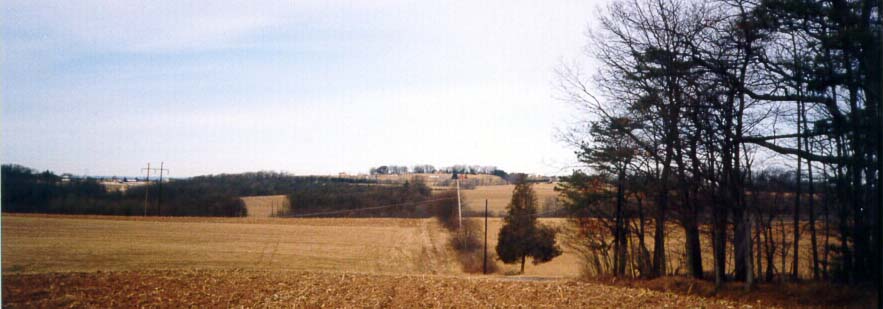
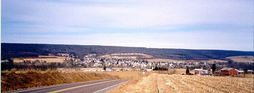
Chestnut Ridge Looking North
I am now standing west-northwest of Schriner's, "right at the
big Jacob Long stone about 1/4-1/2 miles on a ridge." I am facing
north. The
ridge in the background on the horizon, is Chestnut Ridge which
runs east to west. Notice the two-pole power line to the left
(perspective) it
runs north and south. The Appalachian Mountains in this area run
east-west. New Berlin (Shamokin) Mountain, Jack's Mountain, and
Jone's Mountain, which I will speak of later, all run east-west.
Jacks and Jones are about 2200' above sea level, New Berlin Mountain
about
1500'. the land around them is about 500' above sea level. New
Berlin Mountain lies directly behind Chestnut Ridge about 1 mile
to the
north. New Berlin is to the west, front left. Notice the thin
woods in the center of the picture on top of Chestnut ridge. You'll
see that woods
on top of Chestnut from a point 1/3 mile west of it in picture
9. I'll be just west of the power line.
West Jacks
I'm in the same spot facing west. Notice the power line. Typical
hilly farming country. The field is plowed and was in corn last
year. The
Mountain in the background, on the horizon, just right of the
center of the picture, is Jack's. It was named after an indian
trader, Jack
Armstrong, who was killed by indians in 1744. It looks rounded
because you are looking at the end of the mountain. The mountain
ends at
the town of Penns Creek or as it was called Centerville. Penn's
Creek (the stream named after John Penn), runs... you guessed
it west to
east. It begins in a limestone cave to the west (Penn's Cave),
and runs east along the north side of Jack's mountain until it
ends and then
flows through the country to Selinsgrove where it empties into
the Susquehanna River. The western portions of Penn's Creek are
regarded
as one of the best areas in the US to fish for rainbow, brown,
and brook trout. The creek to the west, winds its way in between
the
appalachian mountains, with Jacks to the south. There is nothing
on either side but wooded mountains extending 1600' up.
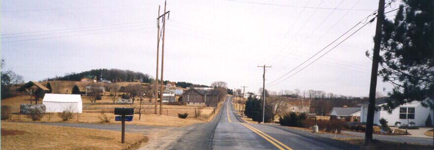
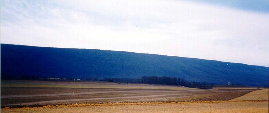
Chestnut Ridge Looking East
Again notice the double pole power line. The woods on the left
at the top of the hill are the "thin woods" I spoke of in Chestnut
Ridge
Looking North. This is it. I'm standing on chestnut ridge. New
houses are being built along here now. This road is called County
Line road.
Union County is to my left, north, and Monroe Twp., Snyder Co.
to my right.
Kratzerville to the Southwest
I'm standing near the same spot I was in the Chestnut Ridge and
West Jacks pictures. Kratzerville is in the center of the picture.
You can
barely see the two blue water towers in the town. Kratzerville
is about half way between Selinsgrove and New Berlin on route
204.
Kratzerville is in Jackson Twp., Snyder Co., and is where my mother's
and my wifes mother's family grew up. Boyers and Klines.
Kratzerville was named for Daniel Kratzer, I believe. Penn's Creek
is between where I am standing and Kratzerville. It flows from
Jack's
Mountain, to New Berlin on my right, past Kratzerville, and to
Selinsgrove to my left.
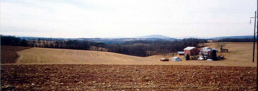
New Berlin Lookin North
Laid out by George Long in 1792. I'm standing in Snyder Co. New
Berlin is in Union. Shriner's is several miles to my forward right,
Kratzerville to my right, and the end of Jack's Mountain to my
left. New Berlin Mountain is in the background. Penn's Creek is
just to the
south of New Berlin flowing left to right, past Kratzerville to
Selinsgrove and the Susquehanna. To the right of New Berlin is
where the
Indians crossed the mountain on October 16, 1755, when they murdered
Jacob LeRoy at the head of Sweitzer Run, and kidnapped his
daughter during the Penn's Creek Massacre. There were 25 families
living in the valley at the time. There was a descrepency between
the
indian tribes known as the six nations, and the settlers regarding
the correct boundries of the treaty of Albany 7/6/1754. They believed
that the land west of the Susquehanna was not part of that treaty.
It was their prized hunting grounds. When I was young we owned
a small
farm that is just across Penn's Creek to the south of New Berlin.
It bordered Penn's Creek.
Jacks Mountain Facing Southwest
I'm standing on a ridge in the Buffalo Valley (The area between
Jack's Mountain to the south, and Jones Mountain to the north),
about 1
mile west of Mifflinburg and 1 mile south east of where I live
now. The end of Jack's Mountain to my left. This gives you an
idea of the
height of the mountain. Penn's Creek is on this side of the mountain.
It follows the north side of the mountain.
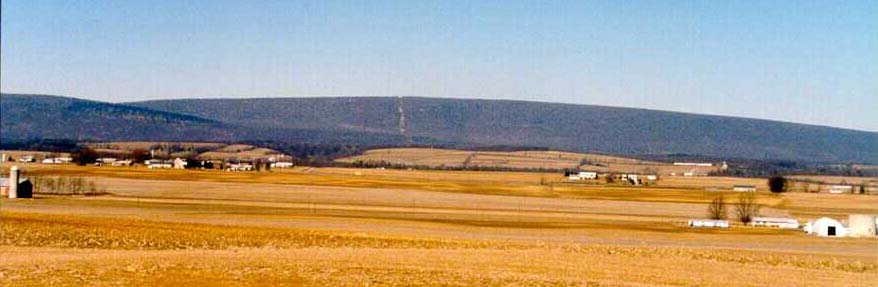
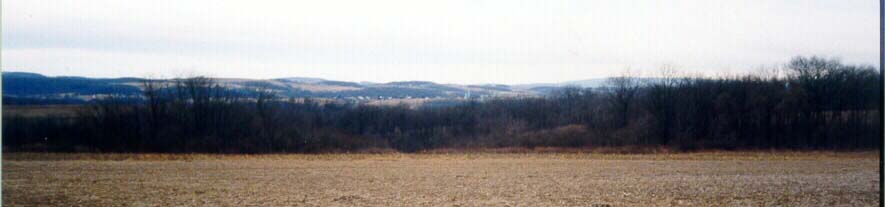
Jones Mountain Facing North/Northwest
The Buffalo Valley looking north, 2 1/2 miles west of Mifflinburg
in Limestone Twp., Union Co. This is prime farmland. There are
actually
3 montains seen here, two end in the picture. These mountains
to the north consist primarily of land that is part of the Bald
Eagle State
Forest which contains land in several counties. The mountain with
the power line crossing it is Jones. Two other mountains in this
area are
Buffalo and Sand Mountain.
| About a Journey into Genealogy: |
| After I first got interested in genealogy on the internet, I met
Terry Long via a post. We did not know at first that we were related,
but found out over time that we had a comon GGGG-Grandfather.
"Chestnut Ridge" was mentioned in the Long Genealogy Book and
I often dreamed of what must have looked like. It was a great
thrill to see the photos that Terry sent as well as the ones from
Schreiners Cemetery. Now everyone who descends from the Peter Long can discover it
here. Thank You Terry! |
|
|
| Genealogy Home |